Drones in Environmental Conservation: Smart Green Solutions
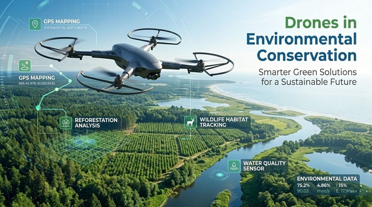
Protecting the environment has become one of the world's most urgent priorities. From deforestation and wildlife loss to pollution and climate change, environmental challenges require faster and more effective solutions. Fortunately, modern drone technology is helping scientists, conservationists, and governments respond more efficiently than ever before.
Drones in Environmental Conservation are transforming how environmental data is collected, analyzed, and acted upon. These unmanned aerial systems can reach difficult locations, gather real-time information, and support large-scale conservation efforts while reducing costs and risks.
As drone capabilities continue to evolve, they are becoming valuable tools for monitoring ecosystems, restoring forests, protecting wildlife, and supporting sustainable development worldwide.
Understanding Drones in Environmental Conservation
Drones in environmental conservation refer to the use of unmanned aerial vehicles (UAVs) to support environmental protection, research, and restoration activities. Equipped with cameras, sensors, GPS technology, and artificial intelligence, drones provide detailed insights into ecosystems without causing significant disruption.
Traditionally, environmental surveys required large teams, expensive aircraft, and considerable time. Today, drones can complete many of these tasks in a fraction of the time and cost.
Moreover, drones provide access to remote mountains, dense forests, wetlands, and coastal regions where traditional monitoring methods may be difficult or dangerous. As a result, environmental organizations increasingly rely on drone technology to make informed decisions and improve conservation outcomes.
Key Benefits of Environmental Monitoring Drones
Faster Data Collection
One of the greatest advantages of Environmental Monitoring Drones is their ability to gather large amounts of data quickly. A drone can survey hundreds of acres in a single flight, capturing high-resolution images and environmental measurements.
Consequently, researchers can identify changes in vegetation, water levels, or land use much faster than with ground-based methods.
Cost Efficiency
Environmental projects often operate under limited budgets. Drone technology reduces the need for helicopters, airplanes, and extensive field teams.
Because drones require fewer resources to operate, organizations can conduct more frequent surveys without significantly increasing costs.
Access to Remote Areas
Many critical ecosystems exist in locations that are difficult to reach. Drones can safely fly over rugged terrain, dense forests, glaciers, and wetlands.
This capability allows conservation teams to collect valuable information without exposing personnel to unnecessary risks.
Improved Accuracy
Modern drones use advanced imaging systems, thermal sensors, LiDAR, and multispectral cameras. These technologies generate highly accurate environmental data.
As a result, scientists can create detailed maps, monitor habitat changes, and measure ecosystem health with greater precision.
How Wildlife Conservation Drones Protect Ecosystems
Wildlife populations face increasing threats from habitat destruction, climate change, and illegal hunting. Fortunately, Wildlife Conservation Drones offer powerful solutions for protecting vulnerable species and ecosystems.
Animal Tracking
Drones help researchers monitor animal movements without disturbing natural behaviors. Thermal imaging cameras can detect animals even in dense vegetation or during nighttime surveys.
This information supports migration studies, population assessments, and habitat management strategies.
Anti-Poaching Operations
Illegal poaching remains a major threat to endangered species. Conservation teams use drones to patrol protected areas and detect suspicious activities in real time.
For example, several wildlife reserves in Africa deploy drones equipped with thermal cameras to identify poachers during nighttime operations.
Habitat Monitoring
Healthy habitats are essential for biodiversity. Drones regularly monitor forests, grasslands, wetlands, and coastal environments to identify habitat degradation before it becomes severe.
Early detection enables conservation organizations to take corrective action more effectively.
Biodiversity Research
Researchers use drone imagery to study plant species distribution, nesting sites, and ecosystem interactions. These insights help scientists understand biodiversity trends and develop stronger conservation policies.
The Impact of Drone Reforestation Technology
Global deforestation continues to threaten ecosystems, wildlife, and climate stability. However, Drone Reforestation Technology is emerging as an innovative solution for restoring damaged landscapes.
Seed Planting
Specialized drones can disperse seed pods across large areas much faster than manual planting methods. Some systems can plant thousands of seeds within a single day.
This dramatically increases the speed and efficiency of reforestation projects.
Forest Restoration
After wildfires, logging, or natural disasters, drones help restore vegetation by identifying suitable planting zones and monitoring growth progress.
As a result, restoration efforts become more targeted and successful.
Land Assessment
Before planting begins, drones assess soil conditions, terrain characteristics, and vegetation patterns. This information helps determine the most effective restoration strategy.
Better planning often leads to higher seed survival rates and healthier forests.
Large-Scale Environmental Recovery
Several organizations worldwide have already adopted drone-assisted reforestation programs. In some cases, drone technology has accelerated forest restoration efforts across thousands of hectares, demonstrating its potential for large-scale environmental recovery.
Drone-Based Pollution Monitoring and Climate Research
Pollution remains one of the most serious environmental challenges facing communities and ecosystems. Thankfully, Drone-Based Pollution Monitoring provides a faster and more efficient way to identify environmental threats.
Air Quality Monitoring
Drones equipped with specialized sensors can measure pollutants such as carbon dioxide, methane, nitrogen oxides, and particulate matter.
This real-time data helps authorities identify pollution sources and implement corrective measures more quickly.
Water Pollution Detection
Monitoring rivers, lakes, and coastal waters can be difficult using traditional methods. Drones simplify this process by collecting imagery and sensor data across large areas.
Researchers can detect oil spills, chemical contamination, and harmful algal blooms before they cause widespread damage.
Coastal Monitoring
Coastal ecosystems are particularly vulnerable to pollution and climate-related impacts. Drones track shoreline erosion, coral reef health, and marine debris accumulation.
These insights support conservation planning and coastal management efforts.
Climate Data Collection
Climate scientists increasingly use drones to collect atmospheric information. They can measure temperature, humidity, greenhouse gases, and weather conditions with high accuracy.
This data contributes to climate research models and improves our understanding of environmental change.
Sustainable Drone Applications Across Industries
The growth of Sustainable Drone Applications extends beyond conservation organizations. Various industries now use drones to improve environmental performance and resource management.
Agriculture
Farmers use drones to monitor crop health, optimize irrigation, and reduce chemical usage. Precision agriculture helps minimize environmental impact while improving productivity.
Forestry
Forestry professionals employ drones to assess forest health, detect disease outbreaks, and monitor timber resources sustainably.
These practices support responsible forest management and conservation goals.
Marine Conservation
Marine researchers use drones to monitor marine mammals, coral reefs, and coastal habitats. Aerial surveys provide valuable information while minimizing disturbance to sensitive ecosystems.
Renewable Energy Inspections
Wind turbines and solar farms require regular inspections. Drones conduct these assessments efficiently, reducing maintenance costs and improving operational safety.
Furthermore, drone inspections support the expansion of clean energy infrastructure worldwide.
Challenges and Future Opportunities
Despite their advantages, environmental drones still face several challenges.
Regulations
Drone operations must comply with aviation laws and local regulations. Restrictions on flight zones and operating permissions can limit certain conservation activities.
Privacy Concerns
The collection of aerial imagery sometimes raises privacy concerns among local communities. Therefore, organizations must ensure transparent and responsible drone use.
Battery Limitations
Most drones have limited flight durations, which can restrict coverage in large or remote areas. However, battery technology continues to improve.
AI-Powered Environmental Drones
The future of environmental conservation will likely involve greater integration of artificial intelligence. AI-powered drones can automatically identify species, detect environmental threats, and analyze vast datasets in real time.
As machine learning technology advances, environmental monitoring will become even more efficient and accurate.
Conclusion
Environmental protection requires innovative tools capable of addressing increasingly complex challenges. From wildlife protection and forest restoration to pollution detection and climate research, drones are proving their value across numerous conservation efforts.
The rise of Drones in Environmental Conservation demonstrates how technology can support sustainable environmental management while improving efficiency, accuracy, and accessibility. As regulations evolve and drone capabilities continue to expand, these systems will play an even greater role in protecting ecosystems and preserving natural resources for future generations.
The future of conservation is becoming smarter, more connected, and increasingly powered by advanced drone technology.
FAQs
What are drones in environmental conservation?
Drones in environmental conservation are unmanned aerial vehicles used to monitor ecosystems, track wildlife, collect environmental data, and support restoration projects.
How do environmental monitoring drones help researchers?
Environmental monitoring drones collect high-resolution images and sensor data quickly, allowing researchers to analyze environmental conditions with greater speed and accuracy.
What is drone reforestation technology?
Drone reforestation technology uses specialized drones to plant seeds, assess land conditions, and monitor forest recovery, helping accelerate large-scale restoration efforts.
Can drones help reduce pollution?
Yes. Drone-based pollution monitoring systems detect air and water contaminants, identify pollution sources, and provide real-time environmental data for decision-makers.
What industries use sustainable drone applications?
Agriculture, forestry, marine conservation, renewable energy, environmental research, and wildlife protection all benefit from sustainable drone applications.

About Premium Author
This post has been authored and published by one of our premium contributors, who are experts in their fields. They bring high-quality, well-researched content that adds significant value to our platform.
Popular Categories
Stay Connected
Recent Posts